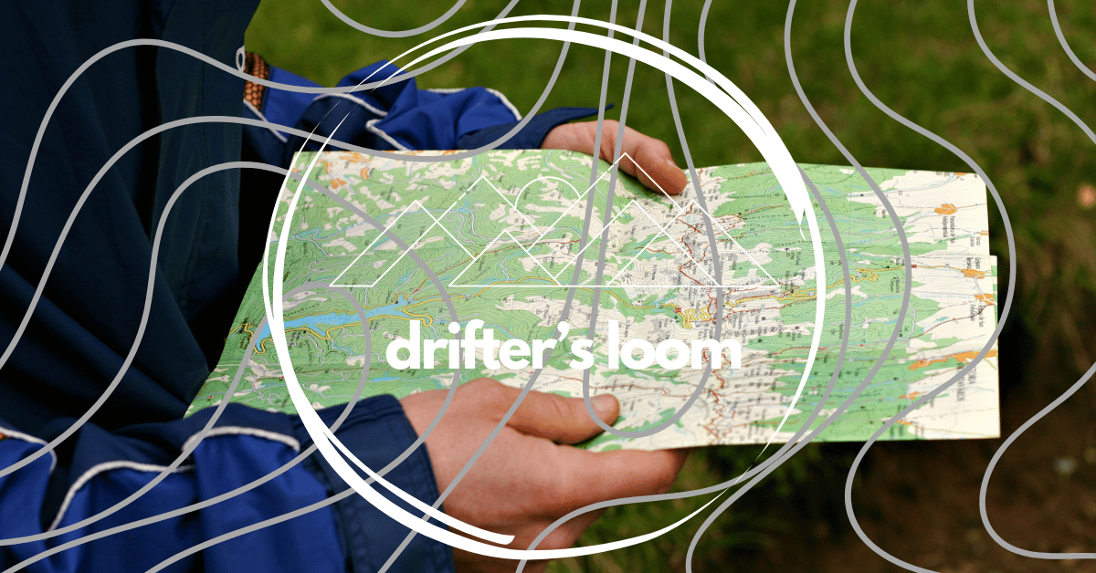
Map reading is one of the most important outdoor skills you can learn. Whether you’re hiking, camping, backpacking, hunting, or exploring remote areas, knowing how to read a map helps you stay safe, plan routes, and navigate confidently without relying on technology. GPS devices can fail, batteries can die, and signals can disappear—but a map and the skills to use it will always work.
This long-form guide explains map reading for outdoor skills step by step, from understanding map symbols to navigating terrain in real-world conditions.
Why Map Reading Matters Outdoors
Map reading is more than just knowing where you are—it’s about understanding the land around you.
Key Benefits of Map Reading
- Improves safety and reduces the risk of getting lost
- Helps plan efficient routes
- Builds confidence in unfamiliar terrain
- Allows navigation without electronic devices
- Enhances overall outdoor awareness
Outdoor maps don’t just show locations—they tell a story about elevation, terrain, water sources, and potential hazards.
Types of Maps Used in Outdoor Navigation
Different outdoor activities use different map types. Understanding them helps you choose the right one for your trip.


4
Topographic Maps
Topographic maps are the most important maps for outdoor navigation.
- Show elevation using contour lines
- Include terrain features such as hills, valleys, rivers, and ridges
- Ideal for hiking, backpacking, and mountaineering
Trail Maps
- Focus on marked trails and landmarks
- Often used in parks and recreational areas
- Less detail about elevation and terrain
Orienteering Maps
- Highly detailed and accurate
- Designed for fast navigation on foot
- Common in competitive navigation events
Understanding Map Orientation
Before reading a map, you must orient it correctly.
What Is Map Orientation?
Map orientation means aligning the map with the real-world direction so that map features match the terrain around you.
How to Orient a Map
- Place the map on a flat surface
- Use a compass to align north on the map with true north
- Rotate the map—not your body—until both match
Once oriented, landmarks on the map should line up with what you see around you.
Map Scale: Measuring Distance Accurately
Map scale tells you how much real-world distance is represented on the map.
Common Map Scales
- 1:24,000 – Highly detailed (1 inch = 2,000 feet)
- 1:50,000 – Good balance of detail and coverage
- 1:100,000 – Large areas, less detail
Why Scale Matters
- Helps estimate hiking time
- Allows accurate route planning
- Prevents underestimating distances
A simple ruler or the map’s scale bar can help measure distance precisely.
Contour Lines: Reading the Shape of the Land
Contour lines are the heart of map reading.


What Contour Lines Show
- Each line represents a specific elevation
- Lines close together = steep terrain
- Lines far apart = gentle slopes
Key Terrain Features
- Hill: Closed circles with higher elevation in the center
- Valley: Contour lines forming a “V” pointing uphill
- Ridge: Contour lines forming a “U” or “V” pointing downhill
- Saddle: Low point between two high areas
Learning to visualize terrain from contour lines allows you to “see” the landscape before you walk it.
Map Symbols and Colors Explained
Maps use standardized symbols and colors to communicate information quickly.
Common Map Colors
- Blue: Water (rivers, lakes, swamps)
- Green: Vegetation or forested areas
- Brown: Contour lines and elevation
- Black: Man-made features (roads, buildings)
- Red: Major roads or boundaries
Important Symbols
- Trails and footpaths
- Campsites and shelters
- Cliffs and dangerous terrain
- Bridges and crossings
Always check the map legend—it explains every symbol used.
Using a Compass with a Map
Map reading becomes far more powerful when paired with a compass.
Basic Compass Skills
- Identify north
- Take bearings
- Follow a direction accurately
Taking a Bearing
- Place the compass edge between your position and destination
- Rotate the housing until lines match north on the map
- Hold the compass flat and turn your body until the needle aligns
This skill is essential in poor visibility or off-trail navigation.
Route Planning with a Map
Good map reading begins before you ever step outside.
How to Plan a Route
- Identify starting and ending points
- Note elevation gain and loss
- Locate water sources and rest points
- Identify hazards such as cliffs or rivers
Choosing the Best Path
- Avoid overly steep climbs when possible
- Use ridgelines and valleys wisely
- Plan escape routes in case conditions change
Proper planning saves time, energy, and reduces risk.
Navigating in Real-World Conditions
Outdoor environments rarely match maps perfectly.
Adapting to Conditions
- Snow may hide trails
- Vegetation can block paths
- Weather can reduce visibility
Navigation Techniques
- Handrails: Use rivers, ridges, or trails as guides
- Catching features: Identify large landmarks beyond your destination
- Pacing: Count steps to estimate distance traveled
Combining map reading with observation keeps you on track.
Common Map Reading Mistakes
Even experienced outdoorspeople make errors.
Mistakes to Avoid
- Ignoring contour lines
- Misjudging distance
- Failing to orient the map
- Relying on one landmark only
- Not checking progress regularly
Frequent map checks prevent small errors from becoming big problems.
Practicing Map Reading Skills
Map reading improves with practice.
Ways to Practice
- Use maps on familiar trails
- Compare map features to real terrain
- Practice route planning at home
- Try orienteering courses
The more you practice, the faster and more confident you become.
Map Reading and Outdoor Safety
Strong navigation skills directly impact safety.
How Map Reading Improves Safety
- Prevents getting lost
- Helps locate emergency exits
- Aids in search-and-rescue situations
- Builds calm decision-making under pressure
A map is not just a tool—it’s a safety system.
🧭 Beginner Map Reading Checklist (Outdoor Skills)
Use this checklist as a simple, practical guide to build strong map-reading skills before heading outdoors. It’s designed for beginners, but even experienced hikers can use it as a quick refresher.
✅ Before You Go (Preparation Checklist)
Map Essentials
☐ Carry the correct map for your area (topographic preferred)
☐ Check the map scale and contour interval
☐ Review the map legend and symbols
☐ Identify key landmarks (trails, rivers, peaks, roads)
Navigation Tools
☐ Compass (baseplate compass recommended)
☐ Map case or waterproof cover
☐ Pencil or marker for route notes
☐ Watch or phone (for time tracking, not navigation)
Route Planning
☐ Mark your start and end points
☐ Plan your main route and backup routes
☐ Note elevation gain and steep sections
☐ Identify water sources and rest spots
☐ Choose clear “catching features” beyond your destination
🗺️ Map Reading Basics to Know
☐ Understand map orientation (north alignment)
☐ Know how to orient the map using terrain or compass
☐ Understand contour lines and elevation
☐ Recognize hills, valleys, ridges, and saddles
☐ Understand map colors (blue, green, brown, black, red)
🧭 Compass Skills Checklist
☐ Identify true north and magnetic north
☐ Align map north with compass north
☐ Take a bearing from map to field
☐ Follow a bearing accurately
☐ Use compass while standing still and while walking
🥾 On-the-Trail Navigation Checklist
☐ Orient your map frequently
☐ Match map features to visible terrain
☐ Track distance using time or pacing
☐ Use handrails (trails, rivers, ridges)
☐ Check your position at every major landmark
☐ Stop and confirm location if unsure
⚠️ Safety & Awareness Checklist
☐ Never rely on memory alone—check the map
☐ Don’t wait until you’re lost to stop and navigate
☐ Avoid steep terrain unless planned
☐ Keep track of daylight and weather changes
☐ Always know your nearest exit route
🧠 Common Beginner Mistakes to Avoid
☐ Ignoring contour lines
☐ Walking too far without checking position
☐ Misjudging distance or elevation gain
☐ Confusing ridges with valleys
☐ Over-relying on GPS or phone apps
🏕️ Practice & Skill-Building Checklist
☐ Practice in familiar areas first
☐ Compare map features to real terrain
☐ Practice taking bearings at home
☐ Try navigating without trails
☐ Review your route after each trip
⭐ Quick Confidence Check (Before You Start Walking)
Ask yourself:
- Do I know where I am right now?
- Can I point to my location on the map?
- Do I know what terrain is ahead?
- Do I have a clear direction to follow?
If the answer to all four is yes, you’re ready to go.
🌄 Final Tip
Map reading is a skill that grows with repetition. Start slow, check often, and stay curious about the land around you. With this checklist, you’ll build confidence, awareness, and safety every time you head outdoors.
🧭 GPS vs Map and Compass: Which Is Better for Outdoor Navigation?
Modern outdoor navigation often comes down to one big question: Should you rely on GPS, or stick with a traditional map and compass? The truth is, both have strengths and weaknesses. Understanding how they compare—and when to use each—can make a huge difference in safety, confidence, and overall outdoor skill.
This section breaks down GPS vs map and compass in a clear, beginner-friendly way.


What Is GPS Navigation?
GPS (Global Positioning System) uses satellites to pinpoint your location on Earth. In outdoor settings, GPS is commonly used through:
- Smartphones with navigation apps
- Handheld GPS devices
- Smartwatches
Advantages of GPS
- Instant location awareness – Shows exactly where you are
- Easy to use – Minimal training required
- Fast route tracking – Distance, speed, elevation, and time
- Works well on trails – Especially in marked or popular areas
Limitations of GPS
- Requires battery power
- Can fail in dense forest, deep valleys, or bad weather
- Signal loss in remote or mountainous areas
- Encourages passive navigation (less awareness of terrain)
GPS is convenient—but it’s not foolproof.
What Is Map and Compass Navigation?
Map and compass navigation relies on reading terrain, understanding direction, and interpreting topographic information. It’s a manual skill that works anywhere, anytime.
Advantages of Map and Compass
- No batteries required
- Works in all environments
- Provides big-picture awareness of terrain
- Reliable in emergencies
- Builds strong navigation skills
Limitations of Map and Compass
- Requires learning and practice
- Slower than GPS for quick checks
- Easier to make mistakes without experience
While it takes effort to master, map and compass navigation is extremely dependable.
Direct Comparison: GPS vs Map and Compass
| Feature | GPS Navigation | Map & Compass |
|---|---|---|
| Power source | Battery-dependent | No power needed |
| Ease of use | Very easy | Requires training |
| Reliability | Can fail | Extremely reliable |
| Terrain awareness | Limited | Excellent |
| Works in poor signal | No | Yes |
| Emergency readiness | Moderate | High |
| Skill development | Low | High |
When GPS Works Best
GPS is most useful when:
- Hiking on well-marked trails
- Tracking distance, pace, or elevation
- Navigating urban or semi-developed areas
- You need quick confirmation of location
For beginners, GPS can boost confidence—but should not replace basic navigation skills.
When Map and Compass Are Better
Map and compass are essential when:
- Traveling off-trail
- Exploring remote wilderness
- Navigating in poor visibility
- Planning complex routes
- Preparing for emergencies
In search-and-rescue, mountaineering, and wilderness travel, map and compass skills are considered critical.
The Biggest Risk: Over-Reliance on GPS
One of the most common outdoor navigation problems is GPS dependency. When people rely only on GPS:
- They stop observing terrain
- They lose sense of direction
- They panic if devices fail
Map reading encourages active navigation, which keeps you mentally engaged with your surroundings.
The Best Approach: Use Both Together
The smartest outdoor navigators don’t choose one—they use both.
How to Combine GPS with Map and Compass
- Use GPS for quick location checks
- Use map and compass for route planning
- Confirm GPS position against map features
- Navigate primarily by terrain, not screen
Think of GPS as a tool, and map reading as a skill.
Which Should Beginners Learn First?
For outdoor skills development:
- Learn map reading basics
- Practice map and compass navigation
- Use GPS as a backup and support tool
This order builds confidence, awareness, and safety.
Final Thoughts: GPS vs Map and Compass
GPS is fast, convenient, and powerful—but it’s not guaranteed. A map and compass are slower and require practice—but they never fail. For true outdoor competence, map reading and compass skills are essential, while GPS should be treated as a helpful companion rather than a replacement.
In the outdoors, technology is optional. Navigation skills are not.
Final Thoughts: Mastering Map Reading for Outdoor Skills
Map reading for outdoor skills is a foundational ability every outdoor enthusiast should develop. It connects you more deeply to the land, improves your awareness, and gives you independence in wild places. While technology is useful, true outdoor confidence comes from understanding where you are, where you’re going, and what lies between.
With consistent practice and the right mindset, map reading becomes second nature—turning every outdoor journey into a safer, smarter, and more rewarding experience.